Satellite Constellation Access to Ground Station
https://au.mathworks.com/help/satcom/ug/satellite-constellation-access-to-groundstation.html

This is summary note from above link reference: https://au.mathworks.com/help/satcom/ug/satellite-constellation-access-to-groundstation.html
[Images are generated locally in Matlab]
Objective:
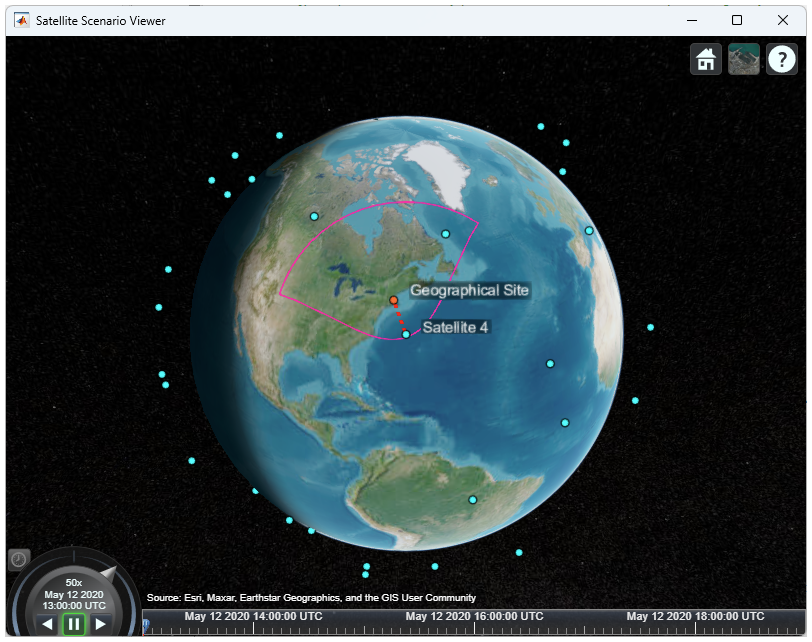
The scenario analyzes when a constellation of 40 low-Earth orbit satellites can photograph a specific geographical site located at 42.3001 degrees North and 71.3504 degrees West. Each satellite has an onboard conical sensor (camera) with a 90-degree field of view. The objective is to determine when each satellite can capture images of the site within a six-hour window.
Timeframe:
The analysis takes place on 12 May 2020, from 1:00 PM to 7:00 PM UTC. The simulation uses a sample time of 30 seconds.
Start: 12-May-2020, 1:00 PM UTC
End: 12-May-2020, 7:00 PM UTC
Sample Time: 30 seconds
Access Conditions:
A satellite can photograph the site if two conditions are met:
- The site is within the camera’s field of view.
- The elevation angle from the satellite to the site is greater than or equal to 30 degrees.
Setup Process:
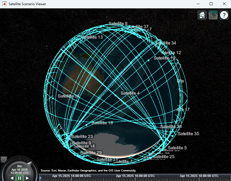
- A satellite scenario is created using MATLAB’s satelliteScenario object.
- Satellites are imported from a TLE file that defines their orbits.
- A conical sensor (camera) with a 90-degree view angle is attached to each satellite.
- A ground station is added to represent the geographical site with a minimum elevation angle requirement of 30 degrees.
- Access analysis is performed between each satellite’s camera and the ground site.
- The satelliteScenarioViewer is used for visual validation.
System-Wide Access Percentage:
This is the percentage of the total 6-hour period during which at least one satellite can photograph the site. To calculate it:
- Access status is computed for each satellite.
- A logical OR operation is applied across all satellites’ access status vectors.
- The result shows whether at least one satellite has access at each time step.
- The number of true values is counted and multiplied by the sample time to get total access time.
- This is divided by the full scenario duration to determine the percentage.


Improvement Through Target Tracking:
Initially, satellites point straight down (nadir), which limits the coverage time due to the fixed field of view. When satellites are made to continuously point at the geographical site using a tracking command, the access intervals improve. This increases the total system-wide access percentage by approximately 36 percent.

Exploration and Adjustments: Various parameters can be modified to influence the results, such as:
- Changing satellite orbits
- Adjusting the ground station’s minimum elevation angle
- Modifying the field of view of the cameras
- Using gimbals for flexible camera pointing
Conclusion:
This example shows how to evaluate access between a satellite constellation and a ground site using sensors, and how sensor orientation and elevation constraints affect imaging opportunities. It also highlights methods for improving coverage and performance by adjusting satellite and sensor behavior.
Reference:
https://au.mathworks.com/help/satcom/ug/satellite-constellation-access-to-groundstation.html